Detector Maps
Start free for 3 days on any yearly plan — nothing charged until the trial ends.
Open the mapThe whole historic landscape, on one map.
Recorded finds, period heatmaps, LiDAR, old maps and the layers that keep you legal — layered together for England, Scotland and Wales.
Find intelligence
Find intelligence.
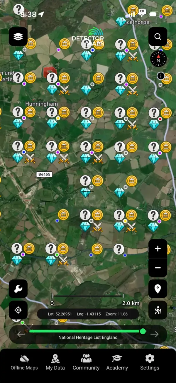
See where finds have actually been recorded. Detector Maps plots recorded findspots from the Portable Antiquities Scheme and British Museum across England & Wales, and Crown-reported objects logged with the Treasure Trove Unit and Canmore in Scotland — layered against scheduled monuments and historic sites. It's a research edge, not a treasure guarantee: it shows you the ground people have walked productively before, so you spend less time guessing on a barren field and more time on land with a real history of activity. We never promise a find — we show you where the evidence points.
Read the historic landscape
Read the historic landscape.
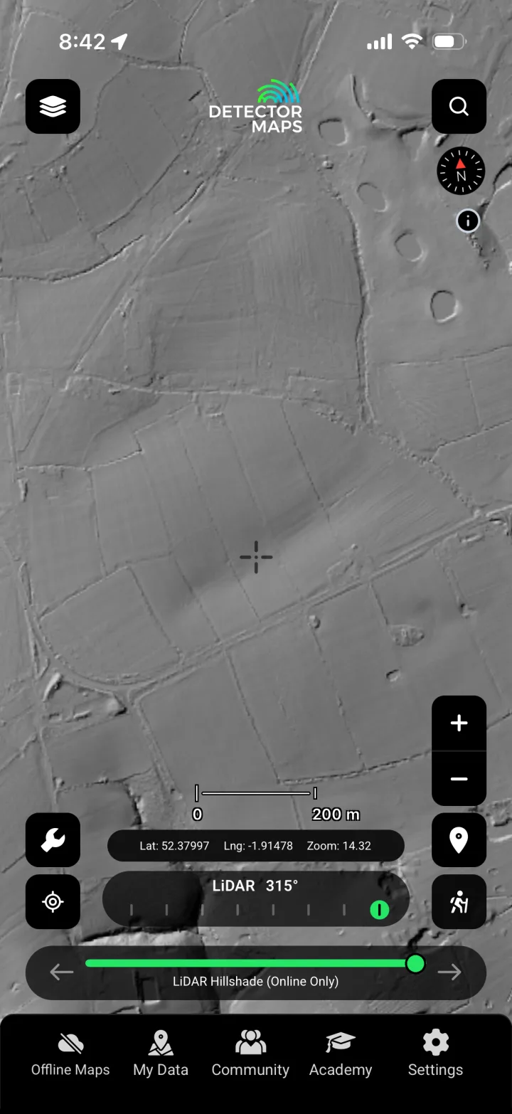
A Roman road, a lost trackway, a ploughed-out medieval farmstead — most of it never shows at ground level. Fade between today's satellite view and Ordnance Survey historical maps to spot vanished settlements and field boundaries. Switch on national LiDAR to read earthworks and terrain the timber hides. Pull up BlueSky’s NDVI crop-mark analysis to catch buried features the soil gives away from the air. GB1900 historic place names tie it all together. Research the landscape like an archaeologist before you ever ask for permission.
Stay legal & responsible
Stay legal & responsible.
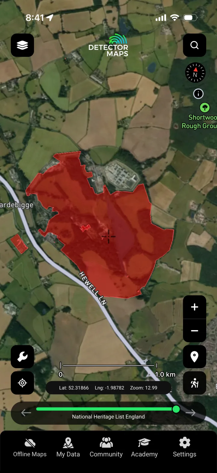
The law is not the same across the UK, and Detector Maps keeps it straight by country. In England & Wales the Treasure Act 1996 applies — you're legally required to report potential treasure to the local coroner, usually within 14 days, and most other finds are recorded voluntarily with the Portable Antiquities Scheme via your Finds Liaison Officer. Scotland is completely different: there is no Treasure Act and no finders-keepers — under Treasure Trove and bona vacantia, ALL archaeological objects of any material belong to the Crown and must be reported to the Treasure Trove Unit. Everywhere, landowner permission is always required before you detect, and detecting on a scheduled monument is illegal without consent. We map the scheduled monuments, SSSIs and no-go zones so you know exactly where you must NOT detect — and we point you to the Code of Practice for Responsible Metal Detecting.
Offline in the field
Offline in the field.
Permission fields sit at the end of a lane with one bar of signal, if that. Download your maps, findspot layers, historic overlays and restriction boundaries before you leave the house, then work the whole field offline. Live GPS keeps you on the right side of the boundary and the scheduled-monument line — no signal required. Mark your own spots, drop notes, and sync them back when you're home.
Every layer comes from a source we can name.
England, Scotland & Wales.
Each country with the right sources and the right law. Open your country's map layers.
The questions we get most.
Do I still need the landowner's permission?
Yes — always. Landowner (and where relevant tenant) permission is required before you detect anywhere in the UK, full stop. Detector Maps helps you research which land is worth asking about and shows the restricted areas, but it never grants access. Get permission in writing and agree a finds arrangement before you go.
What's the difference between the Treasure Act and Treasure Trove?
It depends which country you're in. In England & Wales the Treasure Act 1996 applies: you're legally required to report potential treasure to the local coroner, usually within 14 days. Scotland is completely different — there is no Treasure Act. Under Treasure Trove and bona vacantia, ALL archaeological objects of any material belong to the Crown and must be reported to the Treasure Trove Unit. There is no finders-keepers in Scotland. Detector Maps flags which rules apply where you are.
How does recording finds with the PAS work?
In England & Wales, most non-treasure finds are recorded voluntarily with the Portable Antiquities Scheme (PAS) through your local Finds Liaison Officer — it builds the shared record that makes everyone's research better. Note the PAS does not operate in Scotland; there, archaeological finds go to the Treasure Trove Unit, and sites are recorded in Canmore via Historic Environment Scotland.
Can I detect on a scheduled monument?
No — detecting on a scheduled monument is illegal without consent from the relevant body (Historic England in England, Cadw in Wales, Historic Environment Scotland in Scotland). Detector Maps maps scheduled monuments, SSSIs and other no-go zones so you can see exactly where you must NOT detect before you set out.
Does it cover England, Scotland and Wales?
Yes — all three, with the right sources and the right law for each. England & Wales use PAS / British Museum findspots, Historic England (NHLE) and Cadw / Coflein; Scotland uses Treasure Trove Unit reporting and Canmore (Historic Environment Scotland). Treasure Act rules are shown for England & Wales, Treasure Trove rules for Scotland.
Does it work offline in the field?
Yes. Download your maps, findspot layers, historic overlays and restriction boundaries before you head out, then work the whole field with no signal. Live GPS still keeps you positioned against boundaries and scheduled-monument lines offline.
What devices does it run on?
Detector Maps works on the web and as native iOS and Android apps — research on a big screen at home, then take it to the field on your phone. Your downloads, notes and saved spots sync across all of them.
Will it tell me where to find treasure?
No — and be wary of anything that claims it will. Detector Maps is a research tool, not a treasure guarantee. It shows you where finds have actually been recorded and helps you read the historic landscape so you spend less time on low-potential ground. What you find is still down to permission, fieldcraft and luck.
Research smarter. Cover more ground.
Start free for 3 days on any yearly plan — card required, nothing charged until the trial ends. Web, iOS and Android. Covering England, Scotland and Wales.